
At 3 to 5 days before landfall, the useful question is not whether a tropical storm is dangerous. It is whether the dock doors on the west side of a warehouse, the access road into a cold-storage site, the supplier plant near a tidal river, or the carrier route into a port district is likely to be underwater while there is still time to move freight, labor, fuel, and inventory.
That is where AI flood forecasting for tropical storm supply chain disruption starts to become operational rather than decorative. A regional flood map can help executives understand exposure. A building-level forecast can tell a logistics director which loads need to leave early, which receiving appointment should be canceled, which substitute lane is worth buying before capacity tightens, and which facility manager needs pumps, barriers, or shutdown procedures before road access disappears.
The strongest current evidence comes from Georgia Tech research published in June 2026. The team reported a physics-informed AI approach that forecast building-level flood depths from tropical storms with more than 90% accuracy, 3 to 5 days ahead of landfall, using Hurricane Sandy as a test case. The system combined storm surge, rainfall, and river flooding inputs with generative AI to produce street-level inundation maps rather than broad regional risk zones.[1]
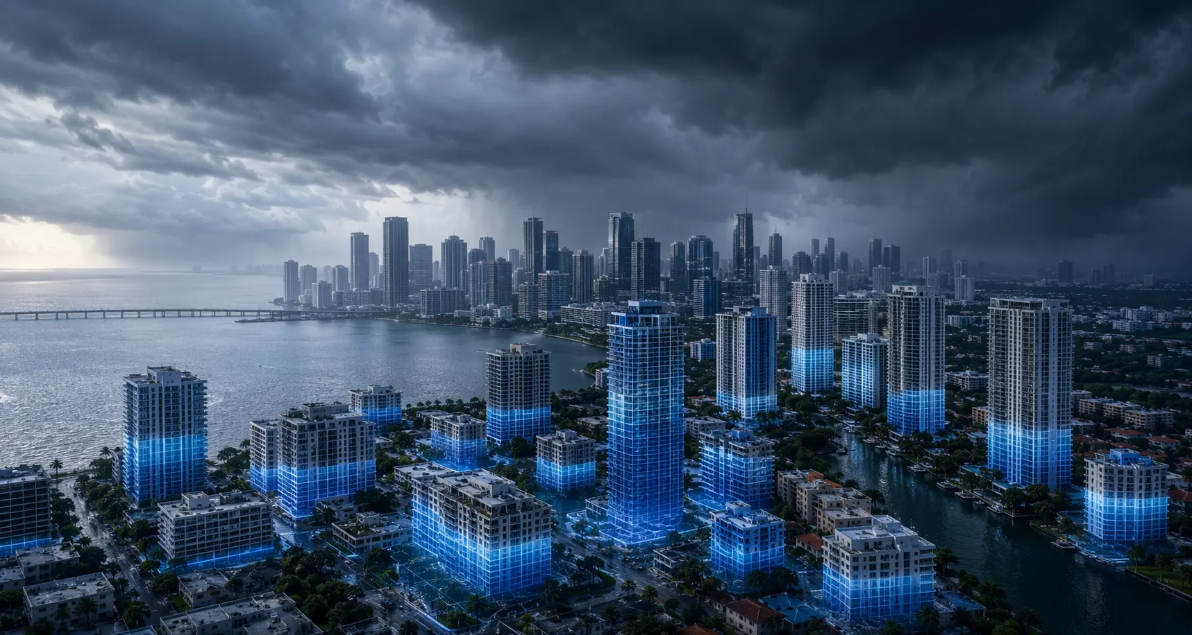
The distinction matters. Most supply chain disruption decisions do not happen at the county level. They happen asset by asset: open or close this yard, advance this inbound shipment, divert this refrigerated trailer, protect this substation, call this supplier, move this SKU, reserve this carrier capacity. A forecast that narrows flood depth to individual buildings and streets gives risk teams a different kind of planning unit.
What the Georgia Tech Result Actually Changes
A 3-to-5-day window is not luxurious in a hurricane. It is, however, long enough to make some decisions before the market around the storm hardens. Carriers have not all repositioned. Drivers may still be available. Alternate warehouse space may still be negotiable. Inventory can still move before mandatory closures, fuel shortages, or flooded road segments turn a controllable exception into a waiting game.
The Georgia Tech model is important because it does not treat flooding as a single mechanism. Tropical storm losses often come from overlapping water sources: coastal surge moving inland, rainfall overwhelming local drainage, and rivers rising after the storm track has already shifted attention elsewhere. By integrating storm surge, rainfall, and river flood models, then using generative AI to produce high-resolution inundation maps, the approach is closer to the way operations teams experience the event on the ground.[1]
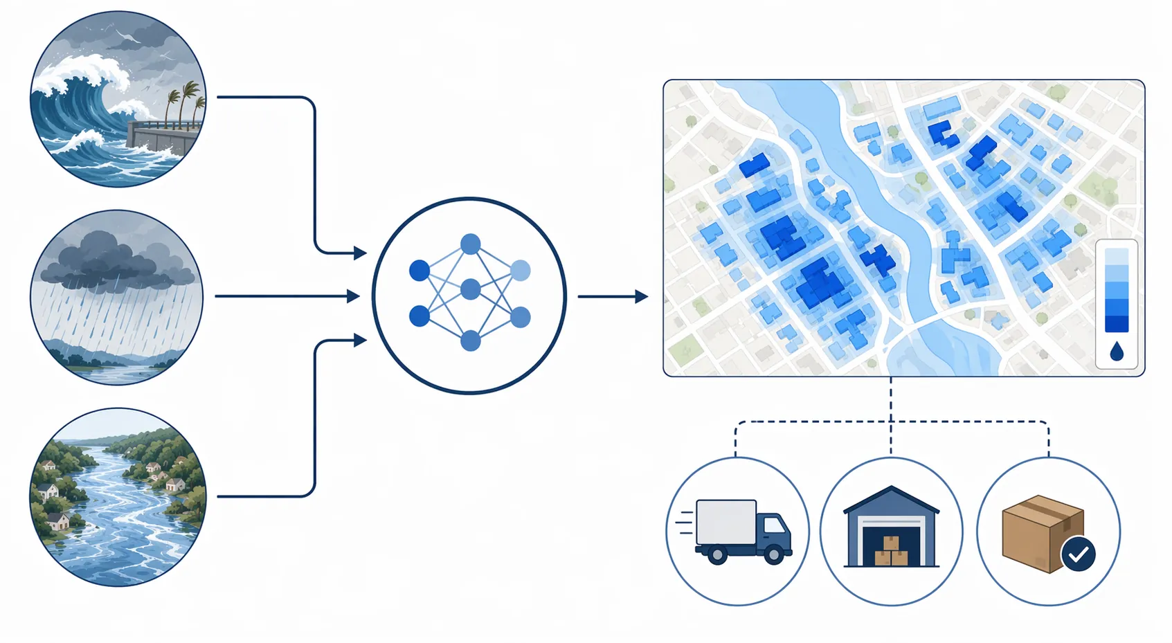
For supply chain teams, the output is not just a map. It is a queue of decisions:
- Facility exposure: which warehouses, plants, cross-docks, cold-storage buildings, repair depots, or supplier sites are likely to see flood depth above an internal action threshold.
- Route viability: which access roads, port approaches, rail-adjacent roads, and last-mile corridors may fail even if the facility itself remains dry.
- Inventory repositioning: which stock should be pulled forward, shifted inland, or allocated away from a threatened node before transportation options narrow.
- Shipment timing: which outbound loads should be advanced, held, split, or rerouted before detention, missed appointments, and downstream shortages begin.
- Infrastructure protection: which critical equipment, backup generators, electrical rooms, refrigeration systems, charging assets, or yard inventory need physical protection.
That list is deliberately operational. Forecast accuracy has limited value if the output arrives as a beautiful dashboard after labor is dismissed, carriers are booked, and local roads have already begun closing.
The Evidence Is Strong, but Not Yet an End-to-End Supply Chain Proof
The Georgia Tech work was designed for emergency management and power grid resilience, not as a fully deployed supply chain control tower. That boundary should not be ignored. The research supports a narrow and valuable conclusion: physics-informed AI can produce highly accurate building-level flood-depth forecasts several days before landfall in the tested case. It does not, by itself, prove that a manufacturer, retailer, distributor, or logistics provider has already integrated that exact workflow into supplier monitoring, order promising, carrier tendering, inventory deployment, and facility response.
That distinction is not academic. A forecast can be technically credible and still fail inside a company if it is not tied to assets, decision thresholds, accountabilities, and execution systems. The map may know which street floods. The transportation team still needs to know whether that street is on the only approved hazmat route, whether the alternate carrier can service the lane, whether a customer order can ship early, and whether finance will approve premium freight before the storm track is certain.
This is also why the current evidence should be read differently from broad climate or disaster statistics. Since 1970, global damage from tropical cyclones has increased by about 380%, according to the Georgia Tech article’s discussion of the broader risk context.[1] Yale Climate Connections reported that 2025 saw 55 billion-dollar weather disasters globally.[2] Those numbers explain why companies are paying attention, but they do not tell a planner which inbound container, temperature-controlled load, or supplier shipment will miss a delivery window.
More supply-chain-specific indicators point in the same direction. Everstream Analytics cited flood alerts rising 214% year over year in 2024 and global flood economic losses reaching $42 billion per year, up 27% since 2000.[3] Weather-related disruption also shows up on the road network: FHWA figures cited by Geotab put weather-related roadway delays at 23% of U.S. roadway delays, with annual trucking weather delay costs estimated at $2.2 billion to $3.5 billion.[4]
Hurricane Ian gives the economic relevance a sharper edge. Everstream data cited in Economist Impact found a 75% drop in shipments and an added 2.5 days of shipping time during the disruption.[3] ClimateAi also reported a case in which AI risk forecasts helped pre-position inventory ahead of Hurricane Ian, contributing to $15 million in incremental sales. That case is useful as evidence that acting early on AI-driven weather risk can carry commercial value, though it is closer to demand and inventory positioning than to proof of a complete building-level flood-depth deployment.[5]
From Flood Forecast to Shipment Decision
A building-level flood forecast becomes useful when it is converted into a decision table before the storm response meeting starts. A risk lead should not have to manually compare a hydrology layer against a spreadsheet of warehouse addresses while procurement asks whether a supplier in the same county is still safe.
| Forecast signal | Supply chain question | Likely action |
|---|---|---|
| Predicted flood depth at facility | Can the site receive, store, produce, or ship safely? | Advance outbound loads, suspend inbound appointments, protect critical equipment, or shift inventory |
| Flooding on access roads | Can trucks reach the gate even if the building is dry? | Reroute, retime, change carrier instructions, or move pickup before road access degrades |
| Flood exposure at supplier plant | Will a component, ingredient, or packaging source lose production or shipping capacity? | Pull forward orders, activate alternate suppliers, or adjust allocation |
| Flood exposure near port, rail, or drayage corridor | Will a modal handoff fail during the storm window? | Divert cargo, change terminal plan, or reserve alternate drayage capacity |
| Uncertain but material exposure | Is the downside large enough to act before confidence is perfect? | Trigger human review, scenario planning, or partial mitigation |
The last row is usually where the argument happens. Operations teams rarely get a binary answer. They get a probability, a depth range, a time window, and a business consequence. A 60% chance of shallow water at a low-volume warehouse is not the same decision as a 60% chance of deeper water at a single-source supplier or a refrigerated distribution center serving hospitals.
That is why a flood forecast should feed thresholds rather than slogans. A company might set one threshold for moving finished goods out of a warehouse, another for pausing inbound receipts, another for dispatching temporary protection to electrical infrastructure, and another for escalating supplier exposure to procurement leadership. The model estimates hazard. The company still has to define when hazard becomes action.
This is where related planning work matters. A broad AI flood risk management program can identify the assets and exposure categories. Hurricane disruption planning can define seasonal playbooks. Building-level tropical storm flood forecasting adds a more precise trigger layer: which physical places are likely to flood in this storm, in this window, at depths that matter to this operation.
The Vendor Landscape Is Adjacent, Not Identical
A company shortlisting tools will see several AI weather and supply chain risk products that sound similar at first glance. They are not interchangeable. Some are stronger at climate exposure, some at storm forecasting, some at cargo impact, some at network risk, and some at route-level ETA slowdown. The Georgia Tech capability is narrower and more specific: physics-informed, building-level flood-depth forecasting for tropical storm inundation.
| Provider or model | Relevant capability | How to read it for tropical storm flood disruption |
|---|---|---|
| Georgia Tech physics-informed AI | Building-level flood-depth forecasts 3 to 5 days before landfall with more than 90% accuracy in the Hurricane Sandy validation case[1] | Most directly relevant to facility- and street-level flood exposure, but not yet shown in the cited source as a complete supply chain operating deployment |
| ClimateAi | ClimateLens Monitor and FICE model for facility-level flood risk across more than 100 economic sectors[5] | Relevant for facility exposure and inventory planning; the Hurricane Ian sales case supports the value of early action, not the same technical proof as Georgia Tech |
| DTN | Deep learning tropical storm model providing hourly wind, precipitation, and storm surge forecasts up to 7 days in advance[6] | Useful upstream weather intelligence for storm preparation; supply chain teams still need asset mapping and execution rules |
| Everstream Analytics | Cargo impact forecasting and weather intelligence, including extreme-weather supply chain indicators[3] | Relevant for shipment and supplier disruption monitoring; not equivalent to a cited building-level flood-depth model |
| The Weather Company / IBM, Interos.ai, and WeatherOptics | Weather modeling, catastrophic risk, and route slowdown prediction capabilities described in the current vendor landscape | Relevant comparison points for shortlist design, especially when flood forecasts must connect to broader control tower, supplier risk, or ETA workflows |
The practical lesson is to separate forecast granularity from workflow coverage. A route slowdown API may help transportation estimate arrival impacts. A supplier-risk platform may show which tier-one or sub-tier sites sit in an exposed region. A storm model may provide earlier meteorological signals. A building-level flood model may say which asset or street is likely to flood. The mature deployment will often need more than one of these capabilities, stitched into a workflow that operations teams can actually use.
That stitching is the hard part. If a flood-depth layer does not connect to the transportation management system, carrier milestones, warehouse appointment schedules, supplier master data, inventory positions, and the control tower’s exception process, it becomes another expert-only screen. It may be right and still arrive too far from the people who can act.
The Deployment Conditions That Decide Whether the Forecast Matters
The first condition is facility-level geocoding. Street addresses are not enough if they resolve to a mailing office, a parcel centroid, or a corporate campus rather than the operating asset. The model’s value depends on knowing the exact location of dock doors, yards, substations, storage tanks, cold rooms, trailer lots, supplier plants, cross-docks, and access points. A few hundred feet can decide whether the relevant asset sits above or below the modeled waterline.
The same applies to routes. A carrier lane written as origin-to-destination is too coarse. Flood exposure needs the road segments that matter: the bridge into the industrial park, the low-lying approach to the port, the road under the rail overpass, the two-mile stretch between the supplier gate and the interstate. A facility that looks safe on the map can become operationally unavailable if every practical access route is compromised.
The second condition is a probabilistic decision framework. More than 90% accuracy in a research validation is impressive, but operations cannot wait for certainty. Companies need pre-agreed thresholds for action, review, and escalation. Those thresholds should reflect consequence, not just confidence. A high-margin seasonal SKU, a lifesaving medical product, a single-source component, and a commodity replenishment shipment should not all trigger the same response at the same probability.
Human review remains necessary because the model does not know every local constraint. A site manager may know that a rear gate is higher than the main entrance. A carrier manager may know that an alternate route is technically open but unavailable for the equipment type. A procurement lead may know that a supplier has already moved finished goods off-site. The AI should narrow the question fast enough for those people to spend their time on judgment rather than discovery.
The third condition is interoperability. Flood forecasts have to land where decisions are already made: ERP for orders and inventory, TMS for shipments and tenders, carrier platforms for capacity and milestones, supplier risk systems for site exposure, and control tower tools for exception management. Readers evaluating AI capabilities for disruption planning should treat tropical storm flood forecasting as a high-value sensing layer, not as a standalone operating model.
A supply chain control tower AI architecture can help if it turns flood predictions into assigned exceptions: this site is above threshold, this route needs review, this load should be advanced, this supplier requires confirmation, this customer order is at risk. It does not help if it merely republishes a map into another dashboard.
A Practical Evaluation Frame
For a supply chain risk team, the evaluation should start with the decision window. Ask whether the forecast arrives early enough to change freight, inventory, labor, facility protection, and supplier actions before the storm response window closes. A seven-day signal may be useful for monitoring, but the 3-to-5-day period before landfall is often where cost, confidence, and execution collide.
Then test the granularity. County-level, ZIP-level, and facility-level are different operating instruments. Building-level flood depth is valuable because it can distinguish between a warehouse that can still ship, a yard that cannot be used, and an access road that strands both. If the use case is tropical storm flooding, do not accept generic weather-risk scoring as a substitute for inundation depth and access-route exposure.
Finally, test the handoff. A forecast should identify the asset, express the uncertainty, show the expected timing and depth, connect to affected orders or shipments, and route the exception to a named owner. If the owner has to export a map, reconcile it against supplier and logistics data, and argue from scratch about the threshold for action, the company has not deployed an operating capability. It has acquired a better warning.
The technical capability is now credible enough to matter. Physics-informed AI can forecast tropical storm flood impacts at the building and street level several days before landfall, and that is precisely the scale at which many supply chain decisions are made. The remaining question is whether companies can connect that forecast to clean asset locations, probabilistic human-in-the-loop thresholds, and interoperable ERP, TMS, carrier, supplier, and control tower workflows before the water reaches the gate.
References
- How AI-Powered Flood Forecasts Could Transform Hurricane Resilience, Georgia Tech, June 30, 2026.
- Earth was hit by 55 billion-dollar weather disasters in 2025, Yale Climate Connections, January 2026.
- The Impact of Extreme Weather on the Supply Chain, Everstream Analytics.
- AI Weather Forecasting and Supply Chain Risk Management, TraxTech.
- Three Ways AI Can Help Companies De-Risk Supply Chains and Capture New Opportunities During Hurricane Season, ClimateAi.
- How Extreme Weather Disrupts the Oil and Gas Sector, DTN.
Comments
Join the discussion with an anonymous comment.