
If flash flooding is expected in the next several hours, AI can increasingly help a supply chain team identify where road inundation is likely. That is already useful for disruption planning, especially when planners need to stage equipment, warn customers, or prepare alternate route scenarios before official closures appear. It is not yet enough to hand routing authority to the model. In 2026, the practical role of AI in flash-flood road disruption planning is early warning and scenario input, not closed-loop rerouting.
The business case is not hard to find. Weather causes 23% of all U.S. road delays and costs trucking companies an estimated $2 billion to $3.5 billion each year, according to Everstream Analytics materials on weather-proofing logistics operations.[1] Flooding also dominated weather-related supply chain disruptions reported for 2024: 70% of those disruptions were attributed to flooding, with 123 U.S. flood events cited in coverage of Everstream’s annual risk report.[2] Those figures do not prove that AI can solve the routing problem, but they do explain why dispatch desks are paying attention.
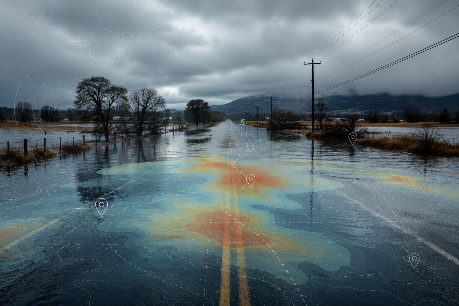
The hard question is narrower than most resilience pitches make it sound: can the system tell a planner which roads are likely to flood early enough, and precisely enough, to change freight decisions without creating a worse exception somewhere else?
The strongest evidence is road-level inundation prediction
The most directly relevant evidence comes from Yuan et al.’s 2023 study on predicting road flooding risk with crowdsourced reports and fine-grained traffic data. The researchers trained Random Forest models to predict road inundation for Hurricane Harvey and Tropical Storm Imelda, using precipitation, topographic, hydrologic, traffic, and crowdsourced inputs. The models reached an AUC of 0.860 for Hurricane Harvey and 0.790 for Tropical Storm Imelda.[3]
Those scores are not a guarantee that any specific segment will be classified correctly at 4 a.m. AUC measures how well a model ranks flooded roads above non-flooded roads across classification thresholds. Operationally, that is still valuable: a planner does not only need a binary answer of open or closed. They often need a ranked watchlist of corridors that deserve review, calls to carriers, or pre-built alternatives before the public road-closure feed catches up.
The model inputs also make physical sense. Precipitation intensity was the single most important predictor for extreme events in the study, while topographic features consistently outperformed hydrologic features.[3] That matters because flash flooding is rarely about rainfall alone. A low road near drainage, a shallow slope, or a segment with poor runoff characteristics can turn the same rainfall forecast into a very different operating risk.
For logistics, the useful part is not simply that the model “uses AI.” It is that it combines signals that a human dispatcher would struggle to synthesize quickly at road-network scale: recent precipitation, elevation, coastal proximity, height above nearest drainage, hydrologic context, traffic behavior, and public reports. That combination can surface places where water is likely to interrupt movement before every affected road has been formally closed.

The Harvey and Imelda results should not be compared too casually. The study used different data sources across the two storm cases: INRIX traffic sensor data for Harvey and Waze crowdsourced reports for Imelda.[3] That asymmetry is not a minor academic footnote. It is exactly the kind of input inconsistency that shows up during a storm, when sensors fail, public reports cluster around populated areas, and road closure information arrives late or unevenly.
A logistics team reading the 0.860 and 0.790 AUC values should treat them as evidence of meaningful predictive capability, not as a service-level promise. The model can help sort risk. It does not know that a refrigerated load has a narrow delivery appointment, that a driver is running out of hours, that a detour crosses a restricted bridge, or that the alternate corridor is already absorbing diverted traffic.
Why the prediction still has to be translated
A flood-risk score becomes operational only after it passes through the constraints of freight execution. The same predicted inundation can be a nuisance, a recoverable delay, or a service failure depending on the load, route, customer, appointment window, and carrier options.
| AI output | Planning question it does not answer by itself |
|---|---|
| A road segment has elevated flood risk | Which loads, drivers, appointments, and customers depend on that segment? |
| A corridor may become hazardous within the forecast window | Is there enough lead time to reroute before hours-of-service, fuel, or appointment constraints bind? |
| An alternate road appears outside the predicted flood area | Can it legally and safely handle the vehicle, weight, bridge clearance, and expected traffic? |
| A city or region has a flash-flood warning | Which shipments should be held, expedited, re-sequenced, or left alone? |
This is where a transportation management system, order data, carrier commitments, and human exception review still matter. The hazard model can tell the planner where to look. The routing decision has to weigh whether moving now reduces exposure or simply transfers the exception to a different road, driver, terminal, or customer.
A useful workflow therefore starts upstream of dispatch, not at the moment of automatic route replacement. The model flags road segments or zones with elevated inundation risk. The control tower maps those risks against active shipments, planned departures, customer commitments, and available alternates. Planners then choose whether to hold freight, pull departures forward, shift appointment times, reroute selected loads, or leave low-risk moves unchanged.
Google’s flash-flood model shows the warning layer is improving
Google’s March 2026 Flood Hub work shows how quickly AI flood forecasting is moving toward broader, near-real-time warning. Its urban flash-flood model uses an LSTM recurrent neural network and provides up to 24 hours of advance notice. It is trained on the Groundsource dataset, which uses news-derived ground truth, and covers areas with population densities above 100 people per square kilometer globally.[4]
The model draws on meteorological inputs from NASA IMERG, NOAA CPC, ECMWF IFS, and Google DeepMind’s weather model, along with static geographic attributes.[4] For public warning, that is a serious expansion of coverage. For supply chain planning, the 24-hour lead time is the most important part. It can give a regional team time to review outbound loads, contact carriers, move yard priorities, and prepare customer communication before water reaches the road network.
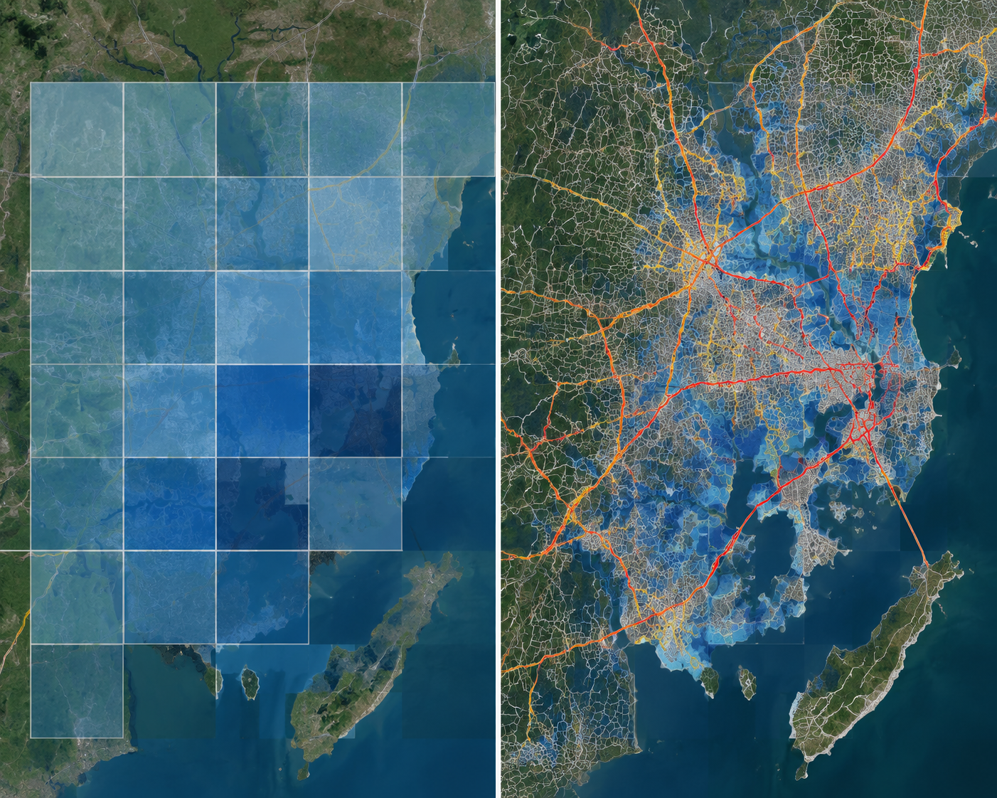
The catch is resolution. Google describes the model at 20 by 20 kilometer resolution.[4] That may be suitable for warning a city or metropolitan area that flash flooding is likely. It is too coarse to decide whether a truck should take one arterial instead of another, whether a specific bridge approach is likely to close, or whether a delivery route can still reach the consignee from the north side of town.
That does not make the model irrelevant to freight. It makes it a trigger. A 20 by 20 kilometer warning can tell a logistics team when to open the exception queue, refresh route-risk overlays, pause automatic tendering into the area, or ask local carriers for ground conditions. It should not be mistaken for lane-level confirmation.
The data problem is as important as the model
The Missouri Department of Transportation’s ARIPS project is a useful reality check because it focuses less on a polished dashboard and more on the training data needed for an all-weather road impact prediction system. The January 2026 technical report describes work assembling precipitation estimates, hydrologic model output, and static fields such as permeability, elevation, and slope into a machine-learning dataset.[5]
The limitation that should make logistics teams pause is timing. The report identifies road-closure records that capture only the day of closure, not the hour, as a major constraint for flash-flood prediction.[5] A day-level closure stamp may be adequate for some archive or maintenance purposes. It is blunt for a phenomenon that can develop in minutes to hours.
That difference matters because machine-learning systems learn from the event history they are given. If the data says a road was closed on Tuesday, the model may not know whether the closure began before the morning outbound wave, during the afternoon delivery window, or after the worst freight exposure had already passed. For planning, that is not a clerical detail. It changes which decisions would have been possible.
ARIPS is also explicitly a work in progress, not a deployed logistics routing product.[5] Its value here is not that it proves state agencies already have a finished answer. It shows the kind of public-sector data plumbing that has to improve before private routing systems can confidently translate flood forecasts into reliable road-impact predictions.
What planners can safely use AI for now
The realistic 2026 use case is a human-in-the-loop disruption workflow. AI flood prediction can narrow the search field, increase lead time, and prioritize review. It can help a planner decide which loads need attention before official closures cascade through road feeds. It should not independently decide that every load crossing a risk polygon must be rerouted.
- Use AI flood signals to create a watchlist of exposed lanes, facilities, and delivery areas.
- Separate city-level or grid-level warnings from road-segment routing decisions.
- Require planners to review alternate routes against vehicle restrictions, appointment windows, driver hours, and customer penalties.
- Track whether alerts arrived early enough to change dispatch decisions, not only whether the model later matched flooded areas.
- Feed post-event outcomes back into planning data, including closure time, reopening time, load impact, and whether the chosen exception action helped.
Vendor-reported results suggest that AI-enabled risk tools may help operations teams identify impacts faster and reduce some avoidable costs. Everstream describes client-reported outcomes including 50% to 70% faster impact identification, a 5% reduction in expedited freight costs, and a 30% reduction in revenue loss in materials on AI for supply chain risk management.[6] Those figures are worth noting as claimed operational benefits, but they are not independently audited benchmarks for flash-flood road closure prediction.
The cleaner planning standard is simpler: did the warning arrive with enough lead time, at enough spatial detail, and with enough confidence to support a decision that the team can defend later? If the answer is yes, AI has done useful work even when a human still approves the reroute. If the answer is no, the system should remain an alerting layer rather than a routing authority.
The 2026 planning judgment
AI can now contribute meaningfully to flash-flood disruption planning for roads. The Yuan et al. results show that road inundation can be predicted with moderate accuracy using a sensible mix of precipitation, terrain, hydrologic, traffic, and crowdsourced data.[3] Google’s work shows that broad flash-flood warnings are becoming more scalable and timely, with up to 24 hours of lead time in covered urban areas.[4] MoDOT’s ARIPS work shows why the last mile remains difficult: if the historical closure record lacks hour-level timing, models struggle to learn events that unfold inside an operating shift.[5]
For supply chain teams, the right implementation is conditional. Put AI flash-flood prediction upstream of routing. Let it trigger scenario planning, shipment exposure analysis, carrier communication, and exception prioritization. Keep humans responsible for the final road-level decision until the system can connect hazard forecasts to shipment commitments, route constraints, and real-time road status with the same discipline that planners already apply under pressure.
References
- Weather-Proof Your Logistics Operations — Everstream Analytics
- Report: Floods Pose Top Threat to Supply Chains in 2025 — Supply Chain Brain
- Predicting road flooding risk with crowdsourced reports and fine-grained traffic data — Computational Urban Science, 2023
- Protecting cities with AI-driven flash flood forecasting — Google Research, March 2026
- Creation of an All-weather Road Impact Prediction System (ARIPS) — MoDOT/CIWRO, January 2026
- Artificial Intelligence's Role in Supply Chain Risk Management — Everstream Analytics
Comments
Join the discussion with an anonymous comment.