
§ 41 — Use-case analysis
Why supply chain AI missed the evacuation disruption during LA fires
This article analyzes how the January 2025 LA fires exposed a critical integration gap: AI evacuation models that predict human behavior during wildfires are not connected to supply chain planning platforms, leaving logistics teams reacting to cascading disruptions rather than anticipating them.
- Function
- supply chain planning
- AI technique
- forecasting
- Failure pattern
- evacuation behavior data integration gap
- Evidence source
- ASU supply chain analysis of LA fires; FLARE evacuation AI research (JHU/UF)
The January 2025 Los Angeles fires became a supply-chain planning problem at the same moment they became an evacuation problem. At peak, 153,000 people were under evacuation orders; road closures on I-5, I-405, and the Pacific Coast Highway disrupted freight routes; and LAX recorded more than 500 flight delays or cancellations tied to smoke conditions.[1] That is not a weather alert with downstream inconvenience. It is a human-mobility event that changed who could work, which roads could carry freight, how long containers sat, and how much slack planners still had before customers felt the failure.
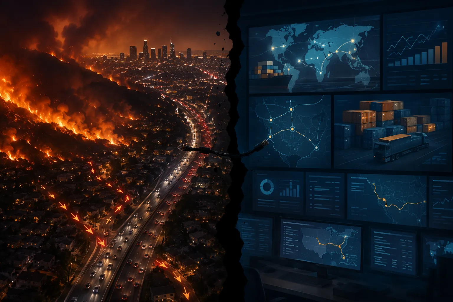
The economic scale explains why this case matters beyond Southern California. The State of Wildfires 2024–2025 report, citing Los Angeles County Economic Development Corporation analysis, put total economic losses from the LA fires at $140 billion, with $4.6 billion to $8.9 billion in lost economic output over five years and 25,000 to 50,000 job-years lost.[2] Those figures are not a neat logistics loss statement, and they should not be treated as one. They do show the size of the operating environment into which transport planners, warehouse managers, carriers, forwarders, and port-adjacent employers were suddenly pushed.
For a logistics IT lead, the uncomfortable part is not that fire, smoke, and closure data existed. Some of it did. The blind spot was that evacuation behavior sat outside the supply-chain planning workflow. The planner could see a lane deteriorating, a facility at risk, or a shipment ETA slipping. What was harder to see in advance was the human layer: which workers were under order, which households were likely to leave late, which road segments would load up with civilian traffic, and how that would turn an open port or nominally available route into a slower operating system.
The evacuation order became a freight event
Arizona State University’s supply-chain analysis of the LA fires is useful because it does not isolate the disruption into a single node. It connects evacuation, labor availability, freight routing, airport disruption, and regional delivery delay. ASU supply-chain expert Hitendra Chaturvedi described worker displacement as a productivity bottleneck, with delivery trucks rerouted over longer distances and businesses facing higher costs and delays.[1]
That bottleneck is easy to under-model. A port can remain operational. A warehouse can remain standing. A carrier can still have assets. But if the people needed to load, drive, inspect, clear, receive, repair, schedule, or answer phones are evacuating families, checking on schools, or unable to cross a closure, capacity becomes theoretical.
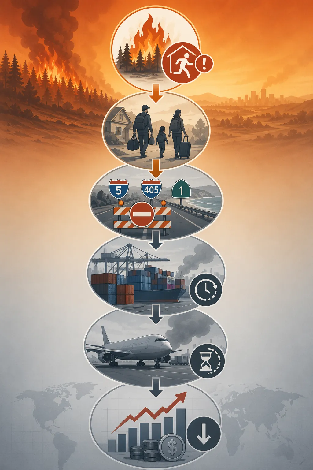
Road closures made the same point physically. I-5, I-405, and PCH are not just lines on a commuter map; they are part of the freight circulation system for Southern California. When those corridors are constrained, trucks do not simply disappear from the plan. They move onto longer or less efficient routes, arrive out of sequence, miss appointment windows, and create new congestion elsewhere. A routing engine can react to a closure. A continuity plan has to anticipate the civilian traffic load that turns a legal alternate into a poor operational choice.
Air cargo had its own version of the cascade. LAX delays and cancellations from smoke conditions affected time-sensitive movement just as ground freight was losing predictability.[1] The operational consequence is not only late air shipments. It is the loss of an escape valve. When ocean, truck, and air options all degrade together, the planning problem stops being modal substitution and becomes priority triage.
Port effects are harder to state with the same confidence. Public logistics commentary from GoComet and JUSDA described the ports of Los Angeles and Long Beach as remaining operational while facing congestion, longer dwell times, dockworker availability pressure, and demurrage cost spikes.[3][4] Those accounts are directionally useful, but they are not the same as independently audited port throughput data for the fire window. The safer conclusion is narrower: the ports were not simply “open” or “closed.” They operated inside a labor-and-congestion environment shaped by evacuation, smoke, roads, and regional demand shifts.
That distinction matters in vendor evaluations. Many planning systems can flag a disrupted facility, a delayed vessel, a carrier exception, or a weather risk. The LA fires exposed a different question: can the planning system ingest and use evacuation intelligence before labor availability, route viability, port dwell, and air cargo capacity degrade at once?
Evacuation AI is getting better at the part SCM tools usually do not see
There is already serious work on modeling evacuation behavior. FLARE, a Johns Hopkins University and University of Florida project funded by a $1.2 million National Science Foundation grant, uses large language models guided by behavioral theory to simulate how civilians make wildfire evacuation decisions. The researchers say the model is validated against survey data and is designed to predict which populations evacuate late, refuse to evacuate, or respond differently to official direction.[5]
The point is not that FLARE is a commercial supply-chain module. Public material does not establish that. Its importance is more specific: it treats evacuees as decision-makers. People wait for confirmation, protect property, coordinate with relatives, distrust or misunderstand orders, or leave only when conditions become undeniable. Those choices change traffic loading and labor availability. A freight planner may never need the psychological model itself, but the planner does need the operational outputs it can help produce.
A related multi-university NSF effort involving the University of Florida, Johns Hopkins, and the University of Utah is developing a convergent AI framework using psychological theory-informed LLM agents to simulate interactions among civilians, commanders, and safety officials during wildfire evacuations.[6] Again, the useful planning signal is not “AI evacuation” as a label. It is the possibility of estimating how official orders and civilian response might load roads, delay departures, or concentrate movement in specific areas.
Commercial and public-sector evacuation tools approach adjacent pieces of the problem. Ladris Evac is positioned around real-time traffic modeling for evacuation. Perimeter focuses on evacuation-zone pre-planning and emergency communication. Esri’s evacuation-planning work emphasizes location intelligence, GIS layers, community characteristics, routes, and operational coordination for emergency managers.[7] These systems belong closer to the evacuation command room than the S&OP meeting, but that is exactly why they matter: they hold signals that supply-chain tools generally do not create on their own.
RAND’s 2025 disaster-AI analysis frames digital twins, predictive analytics, computer vision, and scenario testing as methods already being applied to disaster management, including resource allocation and community scenario testing.[8] That helps set the boundary. The methods are not science fiction, and scenario work is not alien to logistics planning. The missing piece is the connective tissue between emergency-management intelligence and supply-chain execution.
The two prediction stacks appear to stop at the handoff
The public evidence found for major supply-chain planning platforms points to a gap, not a total absence of disruption management. o9, Blue Yonder, Kinaxis, RELEX, and Anaplan all publicly discuss planning, scenario modeling, external signals, control-tower visibility, demand sensing, risk response, or AI-assisted decision support in some form. That is not the same as showing documented ingestion of wildfire evacuation-behavior outputs, real-time evacuation-zone feeds, or civilian movement simulations into supply-chain planning models.
| Planning capability to look for | Why it matters during wildfire evacuation | Public evidence found in the researched materials |
|---|---|---|
| Real-time evacuation-zone feed | Identifies which labor pools, facilities, yards, stores, suppliers, and carrier depots sit inside changing evacuation boundaries | No documented integration found for o9, Blue Yonder, Kinaxis, RELEX, or Anaplan |
| Evacuation-behavior output | Estimates late departures, refusal to evacuate, traffic loading, and civilian response timing | Documented in evacuation-AI research such as FLARE, but not publicly shown as an SCM planning input |
| Labor-availability translation | Turns evacuation exposure into expected staffing constraints for ports, warehouses, drivers, dispatch, and receiving teams | Analytical need is visible from the LA fires; public SCM vendor documentation reviewed did not show this as a wildfire evacuation integration |
| Scenario input for freight rerouting and capacity planning | Lets planners test road closures, smoke disruption, workforce loss, port dwell pressure, and air cargo delay together | Scenario planning is common vendor language; evacuation-behavior integration was not publicly documented |
This is an absence claim, and it should be handled carefully. It does not prove that no customer has built a private connector, no implementation partner has assembled a workaround, or no vendor has a roadmap item under NDA. It says that in the public materials reviewed for this article, no major SCM AI platform documented an integration with wildfire evacuation models or real-time evacuation-zone data feeds.
That is still a material finding. Planning directors do not buy a roadmap rumor; they evaluate observable capability. If a platform says it ingests external signals, the evaluation question is which signals, in what form, at what latency, mapped to which entities, and used by which planning process. A weather alert attached to a facility is not an evacuation-behavior model. A traffic feed is not a labor-availability forecast. A shipment ETA exception is not a pre-cascade warning that a whole region’s workers and roadways are entering an evacuation pattern.
This is also where generic “AI control tower” language can become too loose. A useful wildfire logistics control tower can help with rerouting and exception response; that is a real and adjacent capability, and it belongs in the same evaluation set as AI control towers for wildfire logistics. But the LA fires show that visibility after the disruption starts is not enough. The evacuation layer needs to enter the planning model before trucks, workers, ports, and air cargo all begin reporting symptoms.
Smoke, ports, and roads were visible; civilian movement was not
Some pieces of the LA disruption are already easier for supply-chain AI to observe. Smoke can be detected and modeled as a risk to air quality, facilities, and transport operations; that is why AI smoke-risk detection for supply-chain disruption is a useful adjacent pattern. Vessel, container, carrier, and route data can also show stress as it appears. These are important signals, but they are often symptom signals.
Evacuation behavior is different because it can explain why multiple symptoms appear together. A late evacuation wave can worsen road congestion at the same time warehouse staffing drops. A zone expansion can affect both a driver’s home and a port-adjacent support function. School closures, family relocation, and official orders can reduce available labor even where the facility itself has no flame exposure. The supply chain does not need to classify those as social facts. It needs to convert them into capacity, timing, and confidence intervals.
The same integration lesson appears in other disruption domains. Maritime chokepoint risk, for example, is not solved by separately watching vessels, insurance, conflict alerts, and inventory buffers if the planning system cannot connect them fast enough; that is the parallel problem in maritime chokepoint AI integration. Wildfire evacuation adds a harder layer because the moving asset is not only freight. It is the regional workforce and the civilian traffic stream competing for the same roads.
Everstream Analytics’ 2026 risk framing is a reminder that extreme weather remains a live supply-chain planning priority, citing €43 billion in losses from European extreme weather in summer 2025.[9] That does not by itself prove a vendor can plan through an LA-style evacuation cascade. It raises the bar for what “weather-aware planning” should mean. Extreme-weather risk is no longer credible as a map overlay if the human response to that weather is missing from the planning model.
What a real integration would need to show
Closing the gap is not a matter of adding “evacuation” to a marketing list of external signals. A useful product integration would have to be observable. It would show which evacuation-zone sources are ingested, how frequently they update, how polygons map to sites and labor pools, how uncertainty is represented, and how planners can test the effect on transport, warehouse, port, and customer commitments.
The second requirement is behavioral output, not just official boundary data. Evacuation orders are necessary, but civilian response is what loads roads and removes workers from the schedule. A planning platform does not need to expose a full academic model to the user. It does need to accept outputs such as expected departure timing, late-evacuation likelihood, refusal likelihood, traffic-loading assumptions, and confidence ranges by area or population segment, if those outputs are available from a trusted evacuation model.
The third requirement is translation into logistics terms. “Population under evacuation order” is not yet a supply-chain variable. The platform would need to convert that exposure into likely labor availability by facility, carrier terminal, port function, supplier site, store, warehouse, and customer-service operation. It would also need to show which assumptions are inferred rather than observed. That distinction matters when a planner is deciding whether to pre-position inventory, advance pickups, change appointment windows, or protect capacity for hospitals, utilities, and other priority customers.
- Can the platform ingest real-time evacuation-zone polygons from public agencies or emergency-management systems?
- Can it accept evacuation-behavior outputs, not only weather, traffic, and shipment status feeds?
- Can it map evacuation exposure to labor pools, transport assets, port functions, and warehouse staffing?
- Can planners run compound scenarios that combine evacuation, smoke, road closure, air cargo delay, port dwell pressure, and customer-priority rules?
- Can the system explain which parts of the forecast come from observed feeds, modeled behavior, user assumptions, or manual overrides?
Those questions are deliberately product-level. They avoid the easier claim that “AI should predict disasters” and focus on whether the planning workflow can use the disaster intelligence that already exists elsewhere. FLARE and related evacuation-modeling research are not proven plug-ins for SCM suites. Emergency-management platforms are not inventory optimizers. SCM vendors may have private customer work that public pages do not reveal. But if the capability is real enough for a buyer to depend on during a wildfire, it should be possible to document the feed, the data model, the mapping logic, and the planning action it supports.
The sharper lesson from the LA fires is therefore narrower than “supply-chain AI missed the fires.” The planning systems were better positioned to see physical disruption than human displacement. They could react to blocked roads, late shipments, smoke effects, and congested nodes. What public evidence does not show is a bridge from evacuation intelligence into supply-chain planning before the cascade reached ports, roads, air cargo, warehouses, and labor schedules.
For the next vendor evaluation, that is the benchmark. Not whether the platform says “external signals.” Not whether a dashboard can display a red zone. Whether evacuation-zone feeds and evacuation-behavior outputs can become planning inputs early enough to change capacity decisions before the planner has to say the data existed, but somewhere else.
References
- Measuring the supply chain impact of the LA fires, ASU
- State of Wildfires 2024–2025, ESSD/Copernicus
- How California Wildfires Impact Supply Chain, GoComet
- LA Wildfires Impact Supply Chains, JUSDA
- Researchers use AI tools to model, improve wildfire evacuation, JHU
- Multi-university AI research may revolutionize wildfire evacuation, UF
- Revolutionizing Evacuation Planning with Location Intelligence, Esri
- How AI Is Changing Our Approach to Disasters, RAND
- Are You Prepared for the Supply Chain Disruptions of 2026?, Everstream Analytics
§ 42 — Cited evidence
Flag an inaccuracy or submit a comparable account — Contribute or read how claims are verified in Methodology.