
§ 41 — Use-case analysis
How El Niño and Atlantic Niña Convergence Reshapes Supply Chain Risk
The simultaneous Pacific Super El Niño and Atlantic Niña in 2026 forms a rare double event that hits multiple shipping chokepoints and agricultural regions simultaneously. This article maps the evidence for the convergence and its systemic effects on supply chain planning, drawing on NOAA data, PCA draft restrictions, and agricultural forecasts.
- Function
- demand-forecasting
- AI technique
- forecasting
- Failure pattern
- single-basin planning failure
- Evidence source
- NOAA El Niño declaration (June 2026), Atlantic Niña analysis by Severe Weather Europe (July 2026)
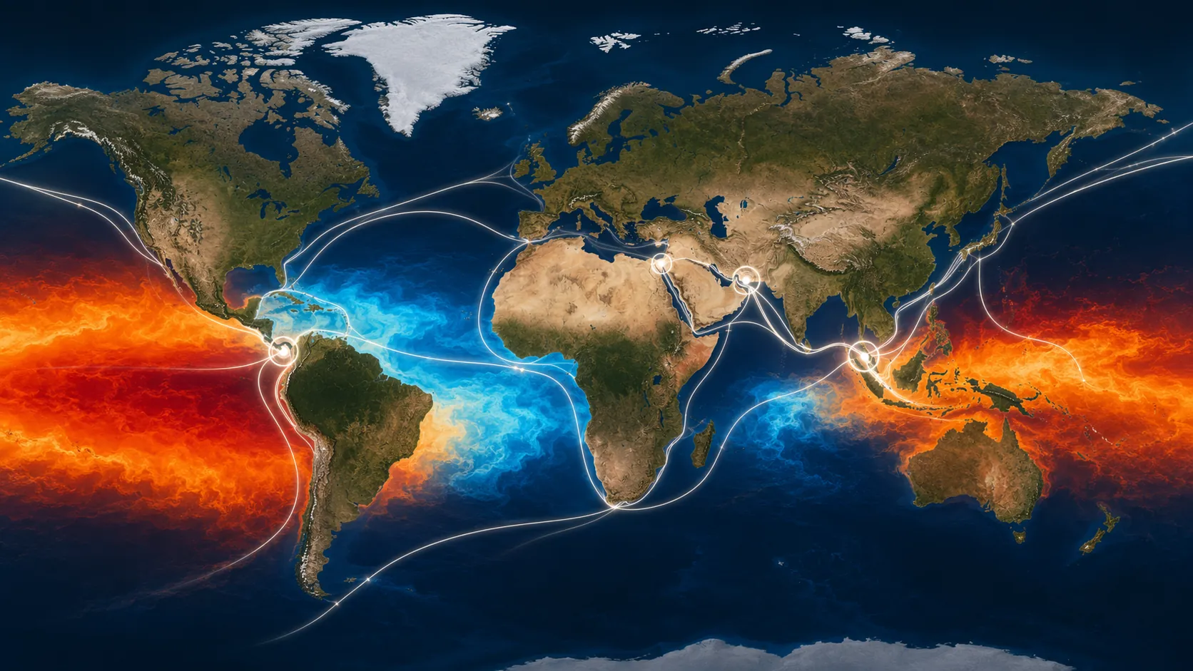
The wrong supply-chain question for Q3 2026 is whether El Niño will make shipping and crops harder to plan. That question is too tidy. NOAA declared El Niño on June 11, 2026, with its Climate Prediction Center giving an 81% chance that conditions become “very strong” by winter 2026-27; at the same time, an Atlantic Niña signal was still emerging, with reporting in mid-July describing a possible rare double event if the Atlantic anomaly persists below -0.5°C.[1][2] By July 6, the Panama Canal had already imposed draft restrictions twice in 2026, affecting Neopanamax locks, even though no full restriction was yet planned.[3]
That is the planning problem: not one ocean basin producing one weather pattern, but two signals pushing on the same network from different sides. A Pacific Super El Niño changes rainfall and heat patterns across Asia and the Americas. An Atlantic Niña, if it holds, cools the tropical Atlantic in a way that can suppress Atlantic hurricane development. The immediate consequence is not a neat offset. It is a more awkward set of linked exposures: canal water levels, Southeast Asian rainfall deficits, agricultural asymmetry, insurance pricing, warehouse positioning, fertilizer access, and chokepoint routing all moving into the same forecast meeting.
Why The Convergence Matters More Than Either Signal Alone
Single-basin playbooks usually rely on compensating assumptions. If El Niño reduces Atlantic hurricane risk, logistics teams may be able to lean a little harder on Atlantic lanes while watching drought in the Pacific-facing parts of their network. If a drought threatens one agricultural region, buyers may look for relief in another. If one canal tightens drafts, routings and inventory can absorb the shock, at a price.
The 2026 setup weakens those assumptions. The Atlantic Niña signal may also suppress Atlantic hurricanes, but that means a calmer Atlantic season is not a clean El Niño offset and cannot be evaluated without asking what the cooler tropical Atlantic is doing to rainfall and circulation elsewhere. Severe Weather Europe and other July reporting described the Atlantic Niña as still conditional, not formally locked in; that distinction matters because the supply-chain response should be staged around persistence, not treated as if the event were already fully declared.[2]
The rarity claim also needs restraint. Reporting tied the setup to research indicating that, if the Atlantic Niña persists, it may be only about the sixth Pacific El Niño and Atlantic Niña double event in more than 40 years.[2] Rare does not mean unprecedented, and it does not mean every modeled impact will appear. It does mean the historical sample that planners instinctively reach for is thin.
Panama Is Already The First Operational Test
The Panama Canal is where the climate signal has already become an operating constraint. Canal transits do not depend only on vessel demand or booking discipline; they depend on freshwater availability in the canal watershed. When rainfall deficits lower the water available for lock operations, the planning variable becomes draft, and draft becomes cargo weight, booking timing, equipment repositioning, and route economics.
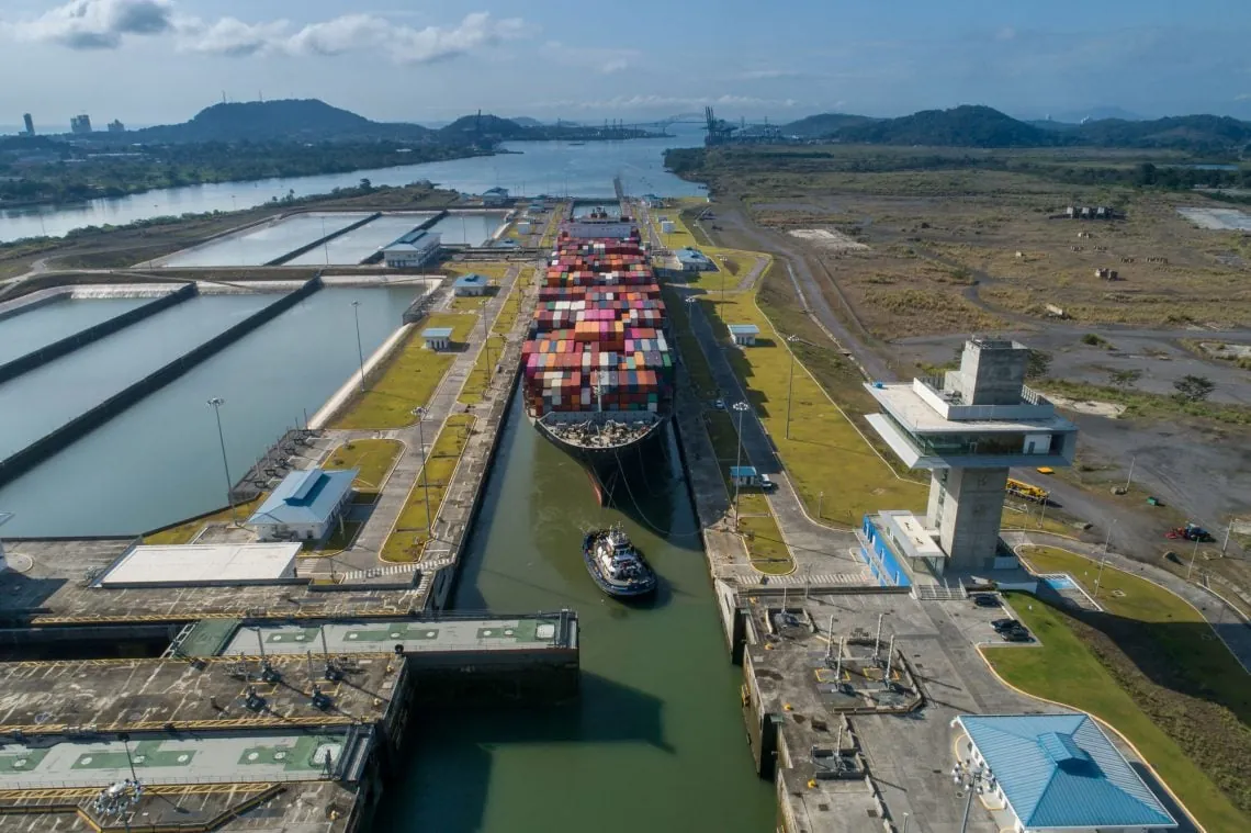
SupplyChainBrain, citing Panama Canal Authority-linked data via gCaptain, reported that the canal had imposed draft restrictions twice in 2026 as of July 6, with Neopanamax locks affected and no full restriction planned yet. The same reporting warned that conditions could deteriorate into 2027 if hydrological pressure persists.[3] That is a narrower fact than “the canal is closing,” but it is already enough to change planning behavior. A draft restriction does not have to stop a vessel to make a supply chain more expensive. It can force lighter loading, earlier booking decisions, cargo splitting, or a shift toward longer alternatives.
This is where the convergence matters. An El Niño-only plan might watch Panama for drought and Atlantic hurricanes for seasonal disruption. A double-event plan has to ask whether the same atmospheric setup is reducing hurricane disruption while still reinforcing drought risk in the canal basin. The absence of one disruption channel can encourage more reliance on a corridor that is already becoming hydrologically constrained.
| Planning Variable | What Changes Under The 2026 Convergence |
|---|---|
| Canal draft | Rainfall deficits translate into vessel-loading limits before they become full transit restrictions. |
| Booking lead time | Shippers may need to reserve canal capacity earlier or keep alternative routings alive longer. |
| Inventory positioning | Warehouses near Atlantic and Gulf demand centers become more valuable if Panama routings lose reliability. |
| Insurance and finance | Climate-linked route uncertainty affects exposure, not just freight cost. |
Southeast Asian Rainfall Turns The Same Signal Into A Crop Problem
The agricultural side is not a separate story. It is the same network constraint showing up in a different ledger. Everstream Analytics reported that portions of Indonesia and Malaysia, including the Singapore area, recently received less than 50% of normal rainfall as El Niño developed.[4] For procurement teams, that figure is not just a weather anomaly. It points toward palm oil exposure, rice market sensitivity, barge and port timing, and packaging or food manufacturing inputs that are often planned with less slack than executives assume.
ORF and PreventionWeb analysis in May 2026 described asymmetric agricultural impacts: drought pressure reducing maize, rice, and wheat output in Asia while wetter conditions support soybean yields in parts of the Americas.[5] That asymmetry is useful, but only if it is used carefully. It does not mean global agriculture nets out. Rice, wheat, palm oil, and soybeans do not substitute cleanly for one another in procurement specifications, consumer demand, animal feed formulas, or national food policy.
Secondary aggregators hectar.global and MAREX cited historical research indicating soybean yield improvements of 2.1% to 5.4% in the United States, Argentina, and Brazil under wetter conditions.[6] That is a real planning input, but it should not be stretched into a universal crop benefit. The operational question is more specific: which buyers can actually use a soybean upside in the Americas to offset drought-linked stress in Asian rice, wheat, or palm oil supply?
Fertilizer exposure adds another layer. The same ORF and PreventionWeb analysis noted that Strait of Hormuz blockages can constrain nitrogenous fertilizer access, compounding crop pressure.[5] That matters because a weather shock to yields can become a procurement shock to inputs before harvest numbers are final. If fertilizer access tightens while drought is already cutting crop potential, the relevant risk is not simply lower output. It is a narrower window to correct the agronomic problem.
The Hurricane Offset Is Real, But It Is Not A Free Hedge
Atlantic Niña’s most tempting planning implication is hurricane suppression. In an ordinary El Niño year, reduced Atlantic hurricane activity can be one of the more usable benefits for supply-chain teams moving through Gulf, Caribbean, and Atlantic lanes. In 2026, that benefit cannot be treated as a clean hedge against the other disruptions because the cooler Atlantic signal is part of the same unusual cross-basin configuration.
A suppressed hurricane season can reduce one class of acute interruption while leaving slower constraints to accumulate. Fewer named-storm disruptions do not refill canal reservoirs, restore Southeast Asian rainfall, or loosen fertilizer chokepoints. They may even encourage overconfidence in Atlantic routings if planners treat the hurricane forecast as the main shipping variable.
TT Club’s warning is useful here because it translates weather into balance-sheet exposure. The insurer described the Super El Niño as a “systemic risk multiplier” affecting supply-chain finance, insurance, warehousing, and logistics at the same time, and noted that three of four major global shipping chokepoints — Panama, Suez, and Hormuz — were under simultaneous pressure.[7] The phrase matters less than the mechanism. When chokepoint stress, cargo insurance, inventory placement, and financing terms all respond to the same forecast cycle, risk no longer sits neatly inside transportation.
Forecast Disagreement Is Part Of The Risk, Not A Footnote
The 2026 forecast environment also has a measurement problem. Descartes Underwriting noted that NOAA moved to a relative ENSO measurement index in February 2026 while other agencies continued using fixed baselines, creating room for divergence between institutional forecasts.[8] The practical consequence is not that one agency is “right” and another is “wrong.” It is that thresholds used in contracts, risk dashboards, and seasonal planning assumptions may not line up as cleanly as they used to.
The same Descartes discussion pointed to a forecast discrepancy: NOAA’s Climate Prediction Center cited a 63% chance of sea-surface temperatures exceeding 2.0°C, while the World Meteorological Organization cited roughly 80% odds for a strong El Niño.[8] Those are not interchangeable statements. One is tied to a specific temperature threshold; the other is a broader strength category. For a planner deciding whether to pre-position inventory, buy optional freight capacity, or renegotiate supplier commitments, that difference changes the timing of action.
The 2023-24 comparison reinforces the caution. A 2025 study in Communications Earth & Environment found that the 2023-24 El Niño’s rainfall effects were only about one-third as strong as prior super El Niños because Atlantic and Indian Ocean warmth suppressed the Pacific signal; Descartes cited that finding in July 2026 as a reason the current cross-basin setup deserves attention.[8] The lesson is not that 2026 will repeat the earlier event. It is that basin interactions can decide whether a familiar ENSO label produces the operational effects planners expect.
Where Single-Basin Plans Break
A single-basin contingency plan usually assigns each climate risk to a familiar owner. Ocean freight watches the canal. Commodity procurement watches crop regions. Insurance watches named storms and aggregate exposure. Treasury watches working capital. Warehousing watches demand centers and safety stock. The 2026 convergence forces those owners to compare assumptions before the disruption becomes obvious.
- If Panama draft restrictions tighten, the freight team may need lighter loading or alternate routings before procurement knows whether crop inputs are also tightening.
- If Southeast Asian rainfall deficits persist, buyers may need to secure rice, wheat, or palm oil exposure while logistics is already reserving capacity around canal uncertainty.
- If Atlantic hurricane risk is lower, insurance teams may see one exposure easing while cargo accumulation, warehouse concentration, and chokepoint dependency increase elsewhere.
- If fertilizer routes through Hormuz are constrained, crop forecasts become less useful unless they are paired with input availability.
Bloomberg described a “$300 billion supply chain” under disruption from El Niño in June 2026, a useful signal of scale but not the proof point for this convergence.[9] The stronger evidence is less dramatic and more operational: dated NOAA probability language, a still-emerging Atlantic Niña signal, canal draft restrictions already imposed, Southeast Asian rainfall deficits, and insurer concern about simultaneous chokepoint pressure.
As of Q3 2026, the supported conclusion is narrower than the worst-case version and more serious than the routine seasonal version. The Pacific Super El Niño and emerging Atlantic Niña are not two parallel weather stories. They form a rare, still-developing convergence that has already produced observable supply-chain effects at the Panama Canal and is pressing against agricultural and logistics assumptions across Asia, the Americas, and major maritime chokepoints. The planning unit is no longer the basin. It is the network.
References
- NOAA El Niño press release, NOAA, June 11, 2026.
- Atlantic Niña reporting citing Mamalakis et al., Severe Weather Europe, July 2026.
- Panama Canal draft restriction reporting citing PCA data via gCaptain, SupplyChainBrain, July 2026.
- Everstream Analytics rainfall advisory, SupplyChainBrain, July 2026.
- El Niño agricultural impact analysis, ORF / PreventionWeb, May 2026.
- El Niño soybean yield impact analysis, hectar.global / MAREX.
- TT Club Super El Niño systemic risk multiplier warning, Air Cargo Week / TT Club.
- Super El Niño and cross-basin forecast divergence analysis, Descartes Underwriting, July 2026.
- El Niño supply chain disruption reporting, Bloomberg, June 24, 2026.
§ 42 — Cited evidence
Flag an inaccuracy or submit a comparable account — Contribute or read how claims are verified in Methodology.